![]() El tramo de Fornells de la Selva a Girona no está gestionado por el Consorci de les Vies Verdes
El tramo de Fornells de la Selva a Girona no está gestionado por el Consorci de les Vies Verdes
![]() Tram en obres | Via verda Pla Gironès Sud
Tram en obres | Via verda Pla Gironès Sud
![]() El tram de Fornells de la Selva a Girona no està gestionat pel Consorci de les Vies Verdes
El tram de Fornells de la Selva a Girona no està gestionat pel Consorci de les Vies Verdes
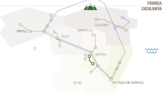
Pla del Gironès Sud Route


Difficulty
Minimal
Surface
Concrete, asphalt, granite sand, tot-ú
Degree of accessibility
Not accessible
Kilometres
35
Elevation difference
2%
Weather forecast
Today, Tuesday, Girona

Clear
9 km/h
24ºC Max.
4ºC Min.
15:00 h
0.75 mm

Wednesday
24ºC Max.
13ºC Min.
Thursday
19ºC Max.
11ºC Min.

Friday
23ºC Max.
10ºC Min.
Saturday
26ºC Max.
12ºC Min.
Rules and recomendations
 Emergency telephone: 112
 Wear a helmet
 Ride to your right
 Keep your dog on a leash
 Use the bins
 Do not occupy the entire road
 Have you detected any incidence? ?
If you have detected any incidence on the routes, you can notify us throught incidence report platform
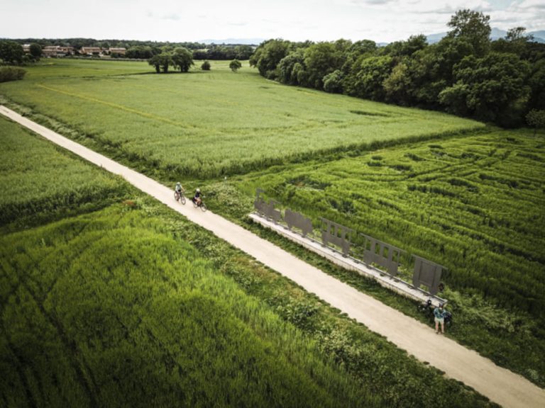
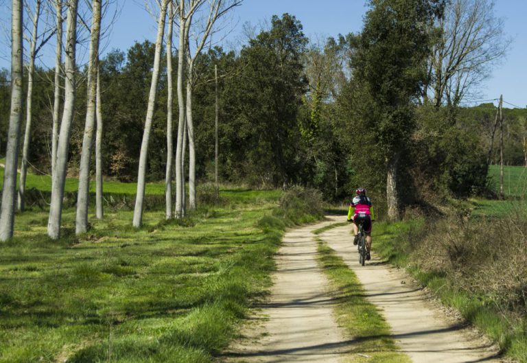
Notify an incidenceThe Pla de Girona greenway is an inter-city route that includes several types of cycling routes: a greenway shared with pedestrians, a two-way bike path, a protected bike lane in the interurban area, and a street with a 30 km/h limit. These routes promote daily walking and bicycle trips and sustainable mobility. In addition, they connect with the classic greenway network, which has a long tourist tradition. The towns are located in the south of Girona, in an environment known as the Pla de Girona (Girona plain), which is the end of the Selva depression and is flanked by the Onyar River. Along the route, you can also find the Gotarra stream and the Verneda stream, an area surrounded by a classic Mediterranean forest, with pines and holm oaks. It is a place of passage between the sea and the mountains — with the Gavarres to the east — which separates the Gironès and the Baix Empordà counties. ℹ️ DECEMBER 2022: The new connections from Llambilles to Campllong, and between Campllong and Riudellots de la Selva are now functional. Check Instamaps for more information.
How to get there

RENFE
Línia Barcelona Sants-Portbou – L’Hospitalet de Llobregat-Figueres/Portbou (R1, RG1, R11)Ticket reservation: Tel. 900 41 00 41
www.rodaliesdecatalunya.cat
renfe.com

TEISA
Tel. 972 20 48 68
www.teisa-bus.com

ROAD
Motorway AP-7 (A-7)
N-II / A-2, GI-673
www.mobilitat.net
GIRONA - COSTA BRAVA AIRPORT
Tourism Office: Tel. 972 186708
Flight Information: Tel. 972 186600
Tel. 972 20 48 68
www.aena.es