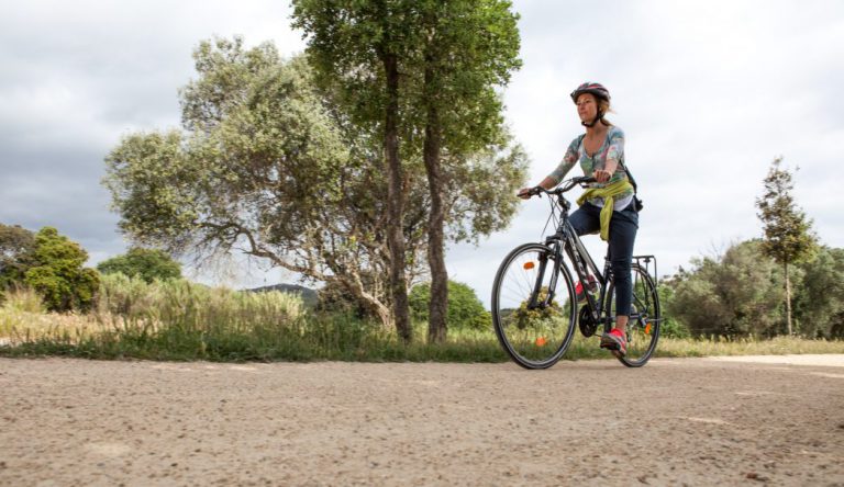
Difficulty
Minimal
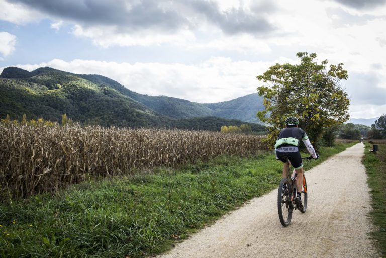
Surface
Packed granite sand
Degree of accessibility
Accessible
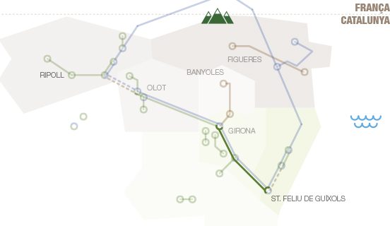
Kilometres
41
Elevation difference
0,5%

Max. altitude
136 m
(Cassà de la Selva)

Min. altitude
0 m
(Sant Feliu de Guíxols)
Services
WC (in stations) , Castell d'Aro All-Terrain Cyclin Center
Weather forecast
Today, Tuesday, Girona

Clear
9 km/h
24ºC Max.
4ºC Min.
15:00 h
0.75 mm

Wednesday
24ºC Max.
13ºC Min.
Thursday
19ºC Max.
11ºC Min.

Friday
23ºC Max.
10ºC Min.
Saturday
26ºC Max.
12ºC Min.
Rules and recomendations
 Emergency telephone: 112
 Wear a helmet
 Ride to your right
 Keep your dog on a leash
 Use the bins
 Do not occupy the entire road
 Have you detected any incidence? ?
If you have detected any incidence on the routes, you can notify us throught incidence report platform
Notify an incidenceThe most salient feature of the railway line trail from Sant Feliu de Guíxols to Girona is the smoothness of its slopes and curves. The route is formed by a winding line that was mathematically mapped out over the rugged terrain. The paving is of a grainy “granite sand” type material that blends in nicely with the terrain it crosses, although there are also urban sections at all the towns that it runs through. After leaving Girona behind, the route crosses the Selva depression, characterised by a patchwork mosaic formed by alternating croplands and forests. On clear days you can enjoy an extraordinary panoramic view that encompasses the easternmost mountains of the Pyrenees range all the way down to the Montseny massif, including the coastal Serralada Transversal (El Far, Sant Roc, Rocacorba). The second half of the section crosses the Ridaura valley, which separates the Cadiretes massif to the south from the Gavarres massif, and runs gently down to the seaside town of Sant Feliu de Guíxols, the birthplace of the Costa Brava place name, which offers breathtaking seascapes and views of the surrounding countryside. When we reach the area of Cassà de la Selva, we can join the Thermal Route, a greenway which takes us to Caldes de Malavella.
How to get there

RENFE
Barcelona – Portbou (Girona Station)
Pl. Espanya, s/n - 17002 Girona
Ticket reservation: tel. 902 24 02 02
www.rodaliesdecatalunya.cat

TEISA BUS COMPANY
Tel. + 34 972 20 48 68
www.teisa-bus.com

HIGHWAYS
AP-7 (A-7) MOTORWAY
C-63, N-1417, N-260 and N-II HIGHWAYS
www.mobilitat.net
GIRONA-COSTA BRAVA AIRPORT
Tourist Office: + 34 972 186708
Flight Information: + 34 972 186600
ot.aerogirona.ctc@gencat.net
www.aena.es
Ryanair bus from the airport to bus station in Girona.