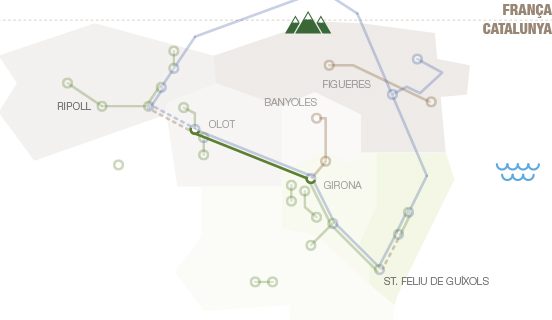
Carrilet I greenway


Difficulty
Medium
Surface
Packed granite sand
Degree of accessibility
Accessible
Kilometres
55
Elevation difference
1,5%

Max. altitude
589 m
(coll d'en Bas)

Min. altitude
68 m
(Girona)
Services
WC (in stations), Picnic area in Les Planes d'Hostoles, Tourist offices
Weather forecast
Today, Tuesday, Girona

Clear
9 km/h
24ºC Max.
4ºC Min.
15:00 h
0.75 mm

Wednesday
24ºC Max.
13ºC Min.
Thursday
19ºC Max.
11ºC Min.

Friday
23ºC Max.
10ºC Min.
Saturday
26ºC Max.
12ºC Min.
Rules and recomendations
 Emergency telephone: 112
 Wear a helmet
 Ride to your right
 Keep your dog on a leash
 Use the bins
 Do not occupy the entire road
 Have you detected any incidence? ?
If you have detected any incidence on the routes, you can notify us throught incidence report platform
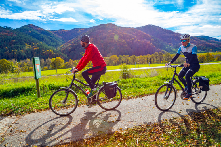
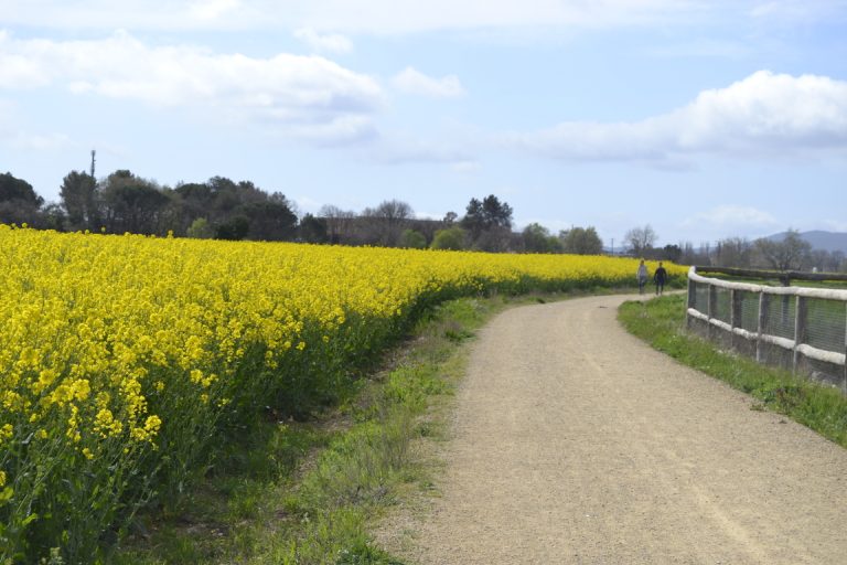
Notify an incidenceThe Carrilet I greenway crosses through magnificent scenery of great ecological and cultural value. It begins in the Garrotxa Volcanic Area, and following the old narrow-gauge railway line, reaches the Ter valley and the pasturelands of Salt and Girona. The old rail line that connected the Garrotxa and Gironès regions now allows visitors to discover the natural resources of the Garrotxa Volcanic Area, the Hostoles castle, and the towns of Anglès, Sant Feliu de Pallerols and Girona, among others. The last section of the trail runs along the Ter River as it crosses the pasturelands of Salt and Girona. Here is where hikers and cyclists alike can see how the river´s resources have been harnessed and put to good use. Once in Girona, join the next stretch of the Carrilet II greenway towards Sant Feliu de Guíxols. You can also opt to cycle the Tren Pinxo route, which currently links Girona and Serinyà. The itinerary of Girona center is the one you will find by default in the download track, but if you prefer to go through the center of Salt, you can download the alternative track in this link Check the water stations on the route here.
How to get there

RENFE
Barcelona – Portbou (Girona Station) -NO train to Olot-
Pl. Espanya, s/n - 17002 Girona
Ticket reservation: tel. 902 24 02 02
www.renfe.com

TEISA
Tel. 972 204 868
www.teisa-bus.com

HIGHWAYS
AUTOPISTA AP-7 (A-7) MOTORWAY
C-63, N-1417, N-260 and N-II Highways
www.mobilitat.net
GIRONA-COSTA BRAVA AIRPORT
Tourist Office: Tel. 972 18 67 08
Flight Information: Tel. 972 18 66 00
ot.aerogirona.ctc@gencat.net
www.aena.es
Ryanair bus from the airport to bus station in Girona.