Difficulty
Minimal
Surface
Compacted sand
Degree of accessibility
Not accessible
Kilometres
13
Elevation difference
0,5%

Max. altitude
140 m

Min. altitude
90 m
Services
WC Cassà de la Selva station, Àrea de pícnic al Parc de les Moleres
Weather forecast
Today, Tuesday, Caldes de Malavella

Clear
12 km/h
23ºC Max.
3ºC Min.
15:00 h
0.11 mm

Wednesday
22ºC Max.
13ºC Min.
Thursday
21ºC Max.
11ºC Min.

Friday
20ºC Max.
10ºC Min.
Saturday
22ºC Max.
11ºC Min.
Rules and recomendations
 Emergency telephone: 112
 Wear a helmet
 Ride to your right
 Keep your dog on a leash
 Use the bins
 Do not occupy the entire road
 Have you detected any incidence? ?
If you have detected any incidence on the routes, you can notify us throught incidence report platform
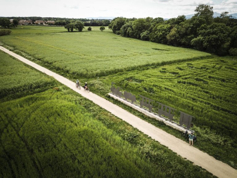
Notify an incidenceStarting the route at the crossing point with the Gauge Railway Route II, we first find the meadow known as the Prat de Dall, which often becomes flooded, resulting in an important diversity of flora and fauna. After crossing the River Cagarella, on the outskirts of Cassà de la Selva, we continue along the Camí de Sant Vicenç d'Esclet, crossing La Sureda woodland, until we reach the road that takes us from Caldes to Llagostera (GI-674), which needs to be crossed with caution. After passing through the Aigües Bones urbanisation, we then reach the Parc de les Moleres via Carrer de Trasmuralla, where we will find various facilities to enjoy some leisure time and relaxation. After leaving the town of Caldes de Malavella, we arrive at the train station where we can find maps and information guides about the route. At this point, and after crossing the underpass found at the train station, the route continues through woods and fields, following the roads of the PGA Golf de Catalunya, until we reach La Creu de la Mà.
![]() This route matches EuroVelo 8, a 7.560 km trans-European cycling route. More information: https://ev8.eurovelospain.com/
This route matches EuroVelo 8, a 7.560 km trans-European cycling route. More information: https://ev8.eurovelospain.com/
How to get there

RENFE
Barcelona Sants-Portbou (Caldes de Malavella Station)
L'Hospitalet de Llobregat-Figueres/Portbou (Caldes de Malavella Station)
Av. Doctor Furest, s/n - 17455 Girona
Tiquets reservation: Tel. 900 41 00 41
www.rodaliesdecatalunya.cat
renfe.com

TEISA
Tel. +34 972 20 48 68
www.teisa-bus.com

ROAD
Motorway AP-7 (A-7)
Highways N-II / A-2, GI-673
www.mobilitat.net
GIRONA-COSTA BRAVA AIRPORT
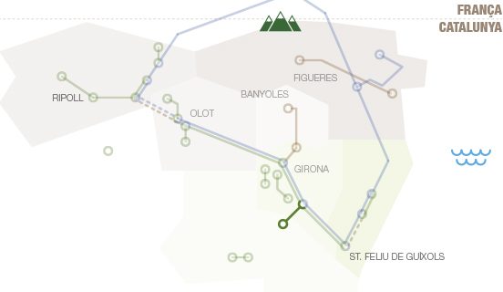
Related routes